
Description
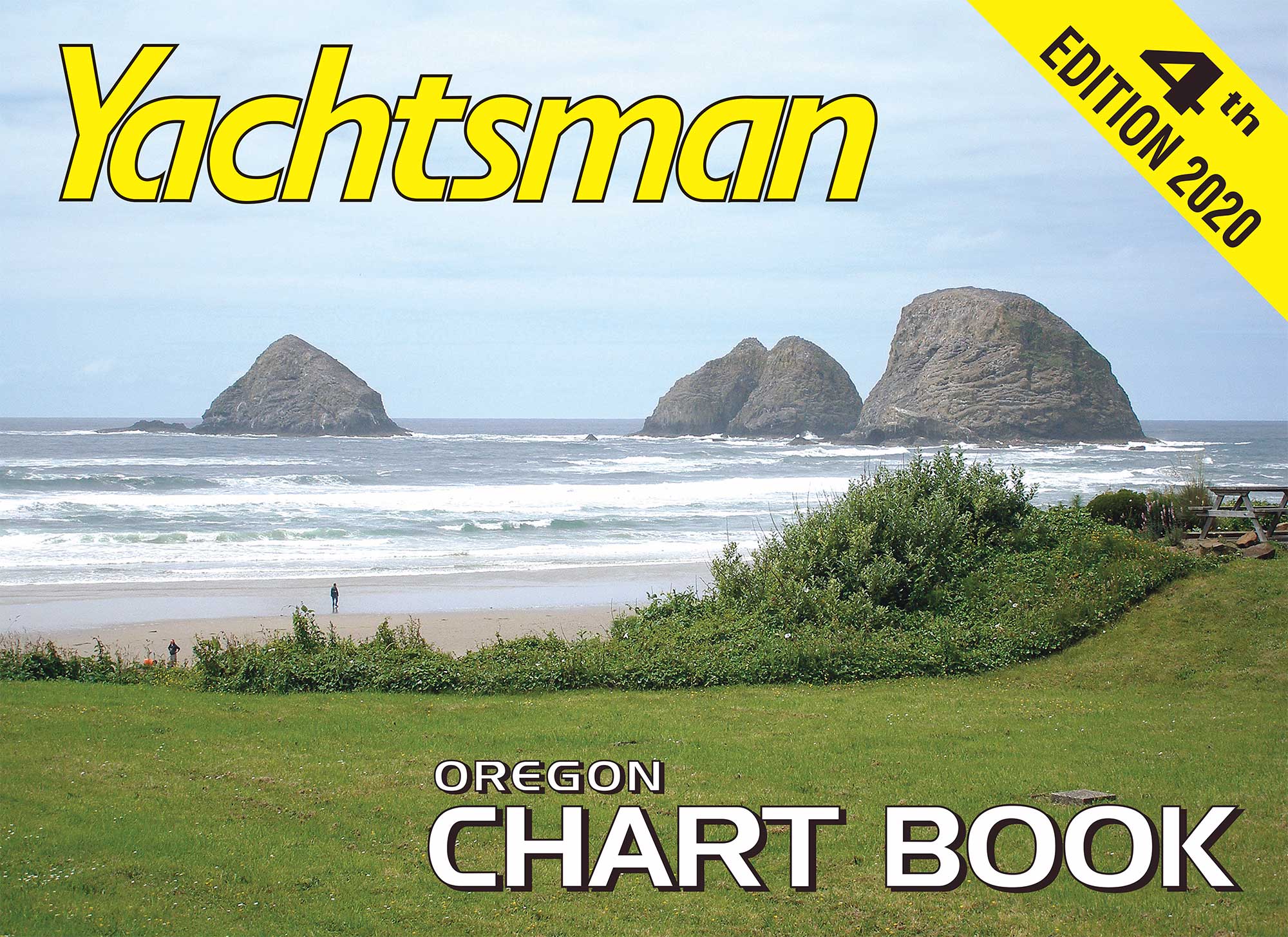
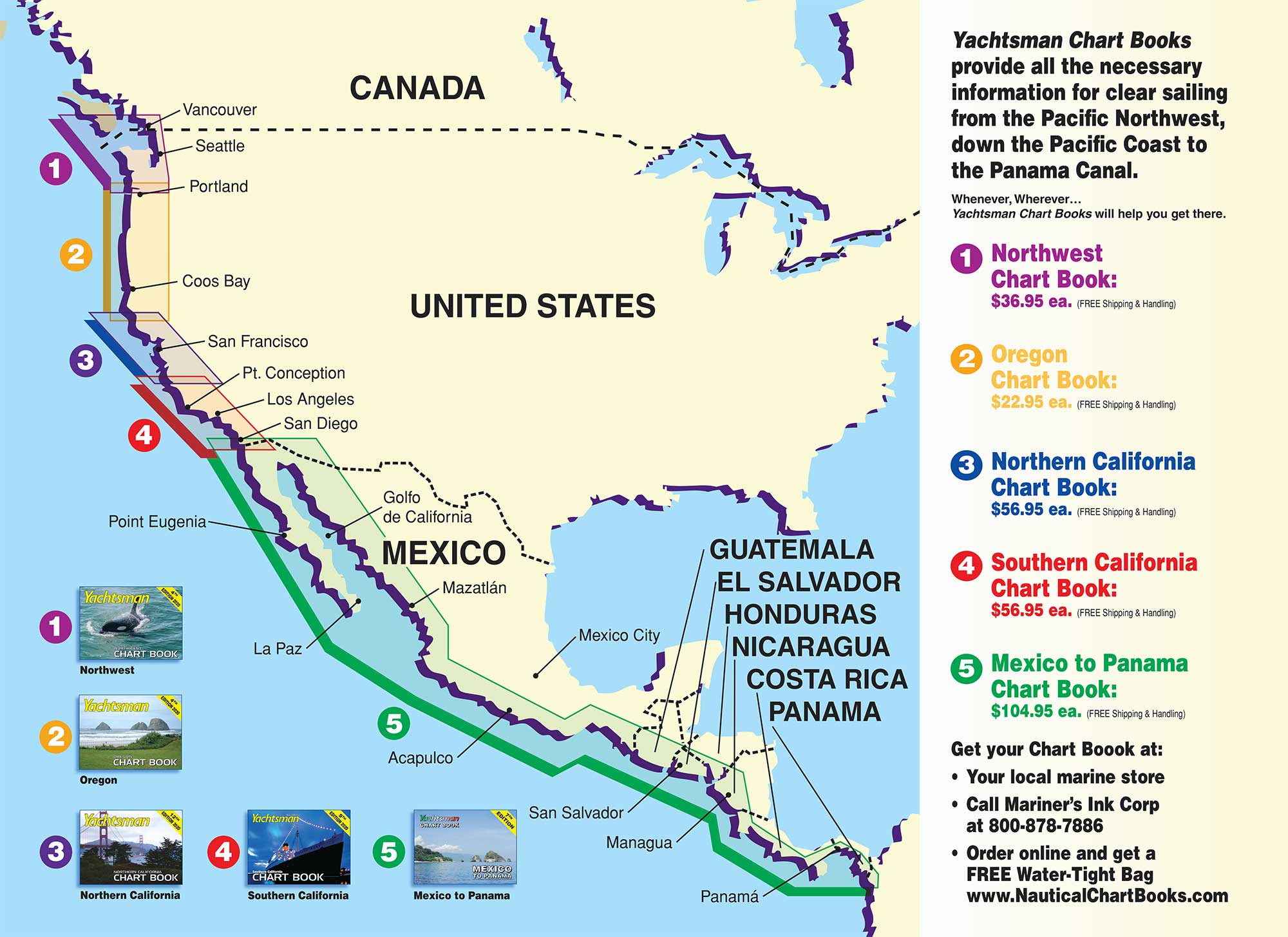
Oregon Chart Book – 4th Edition 2020
38 Pages, 19 NOAA charts, 22″ x 16″ – FREE S&H
Covers the Pacific Coast along the Oregon Coastline from Northern California to Washington and includes the Columbia River all the way up to Vancouver and Portland. See page 2 for details.
YACHTSMAN CHART BOOKS
5 different Chart Books provide all necessary information for clear sailing from the Canadian border down the USA coast all the way to the Panama Canal, including the Sea of Cortez.
Yachtsman Chart Books are easy to use, inexpensive and designed to fit your needs and your chart table.
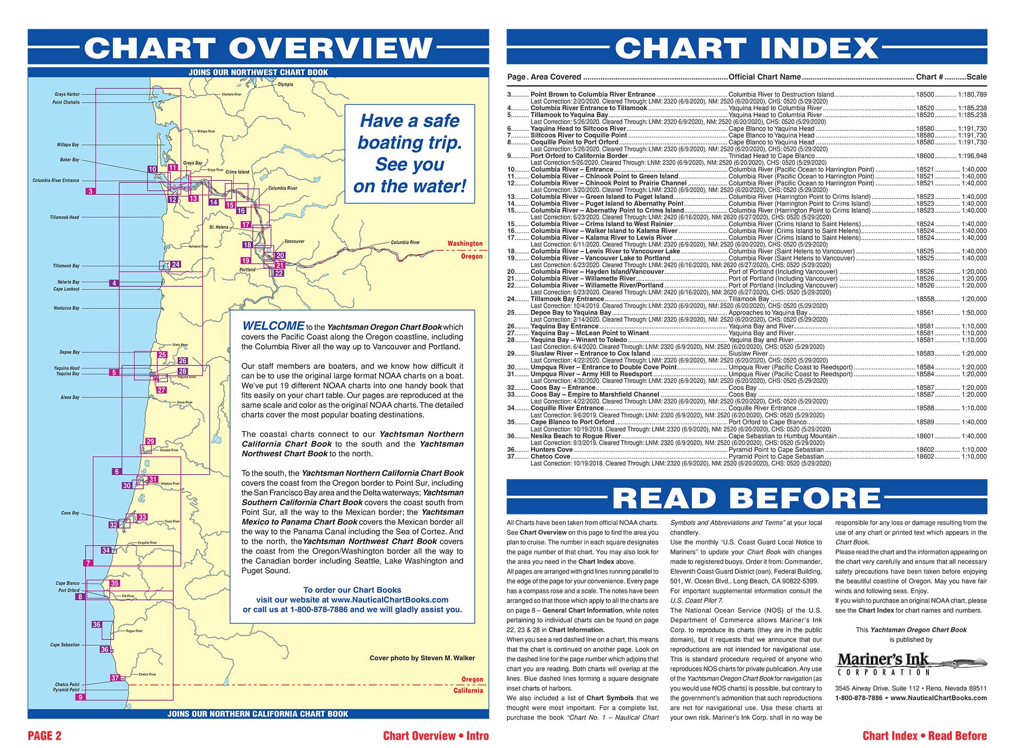
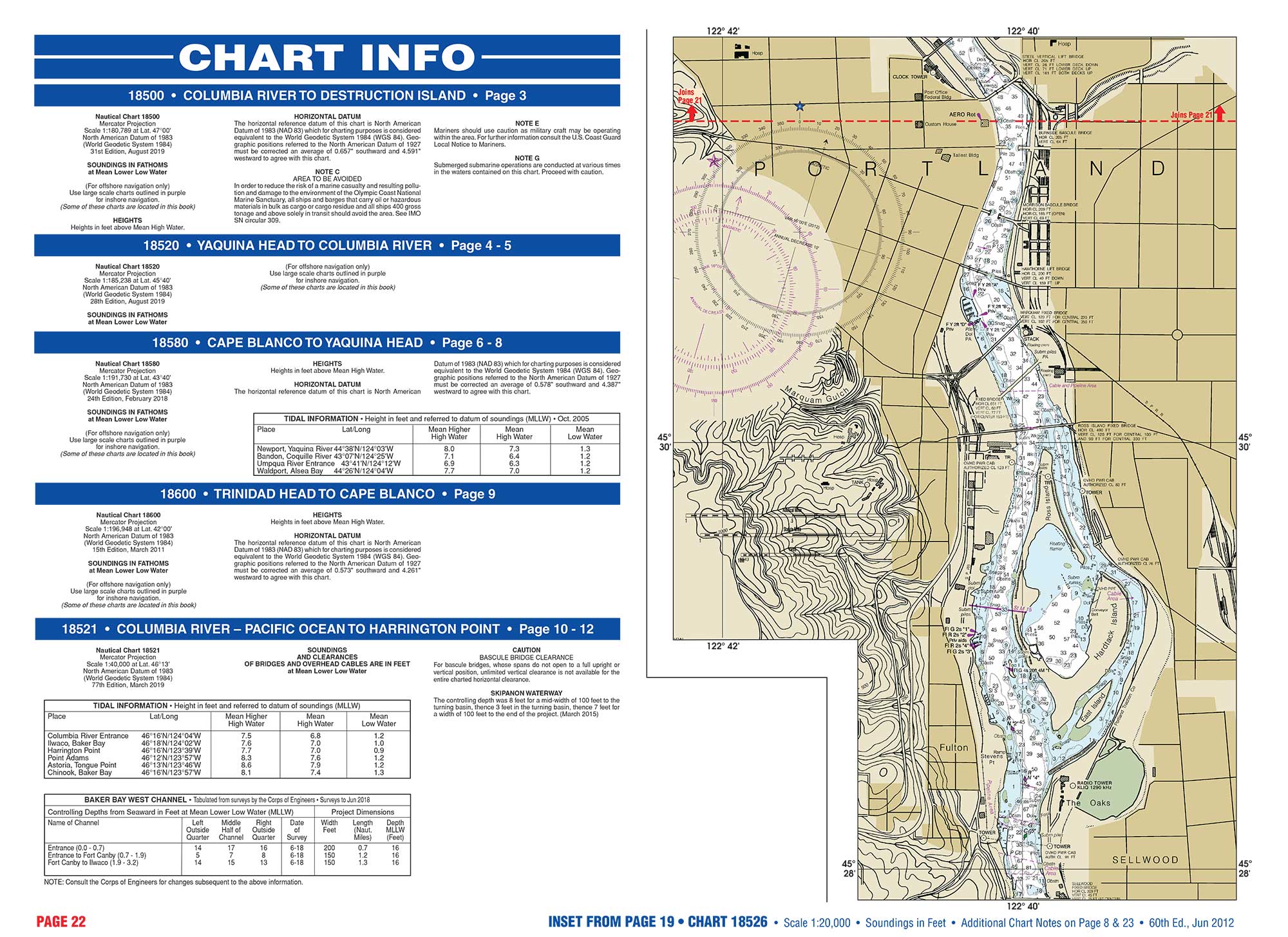
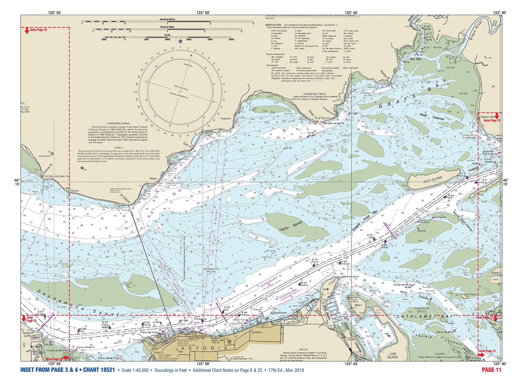
All Charts have been taken from official NOAA charts. See Chart Overview on page 2 to find the area you plan to cruise. The number in each square designates the page number of that chart. You may also look for the area you need in the Chart Index also on page 2.
All pages are arranged with grid lines running parallel to the edge of the page for your convenience. Every page has a compass rose and a scale. The notes have been arranged so that those which apply to all the charts are on the General Chart Information page, while notes pertaining to individual charts can be found near those charts in Specific Chart Information.
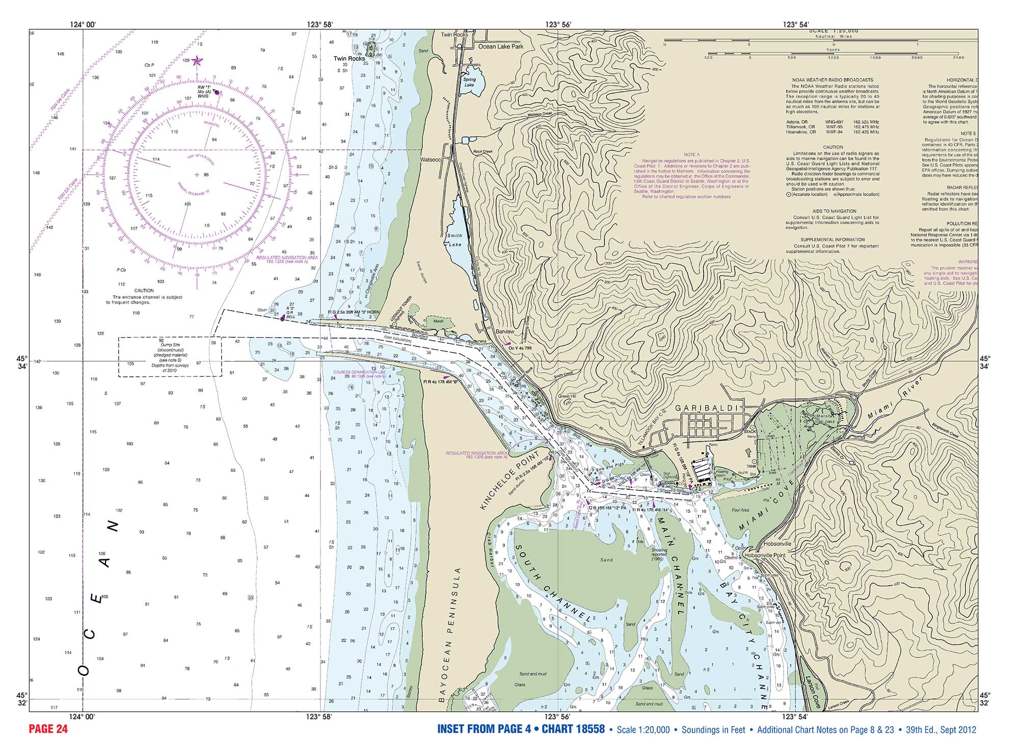
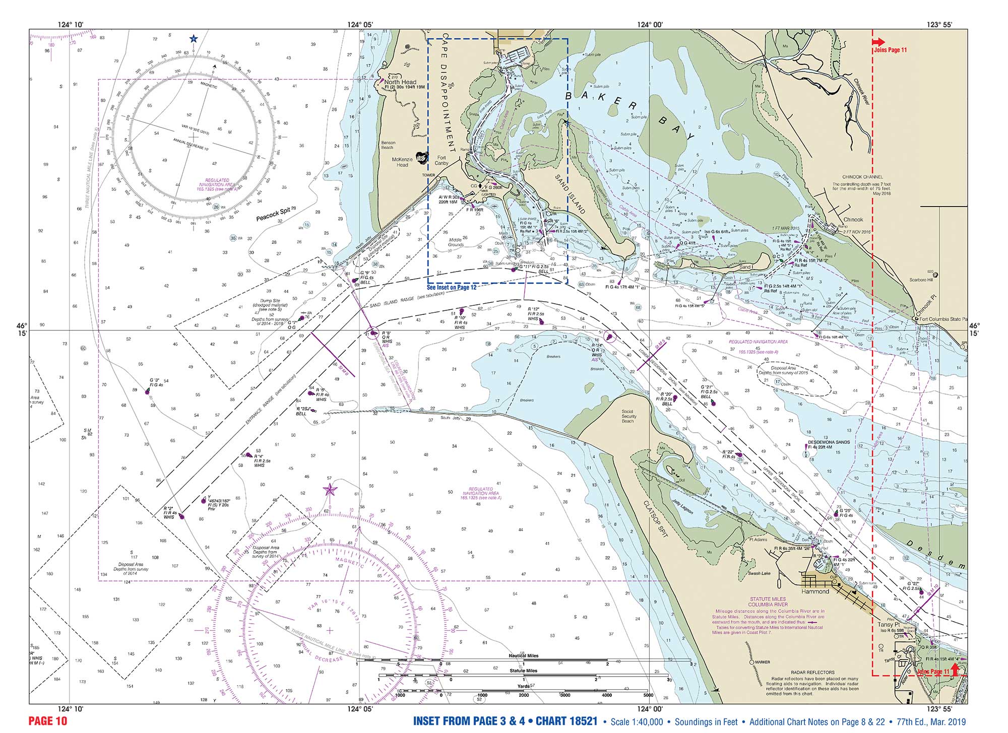
When you see a red dotted line on a chart, this means that the chart is continued on another page. Look on the dotted line for the page number which adjoins that chart you are reading. Both charts will overlap at the lines. Blue dotted lines forming a square designate inset charts of harbors.
We also included is a list of Chart Symbols that we thought were most important.
Be sure to Read Before on page 2, for complete informations.